


GPS Topographic Survey Equipment | Overview & Techniques
Explore the intricacies of GPS topographic survey equipment, their applications, advanced techniques, and future trends, with a spotlight on Getac Solutions.
DEFINITION OF GPS TOPOGRAPHIC SURVEY
GPS, or the Global Positioning System, is a satellite-based navigation system that allows users to determine their approximate location (latitude, longitude, and altitude) anywhere on Earth, using radio signals. A GPS topographic survey is performed when a Land Surveyor uses these radio signals and other tools to gather data about the Earth's surface, including the contours, elevations, and features present.

Importance and Benefits of
GPS Topographic Surveying
Embracing GPS for topographic surveying brings about numerous advantages. These include greater accuracy in mapping the Earth's surface, reduced time and cost compared to traditional methods, and the ability to survey even in challenging terrains.
Applications of
GPS Topographic Survey Equipment

Environmental and Natural Resource Management
For environmental studies, GPS equipment assists in tracking changes to landscapes, monitoring endangered habitats, and managing natural resources effectively.

Land Surveying and Property Management
In land surveying, GPS survey equipment helps determine property lines, plot land, measure, and carry out boundary surveys. Land surveyors depend on the equipment to gain precise measurements of distances and angles between different points on land.
Transportation and Infrastructure Planning
Planning roads, railways, and airports requires detailed topographic data. GPS instruments provide this data, enabling planners to accurately determine the best routes and locations.

Construction and Infrastructure Development
Engineers and surveyors utilize GPS topographic survey equipment in construction for site planning, layout, and infrastructure development. The accurate data helps in designing and placing structures with precision and accuracy.

Disaster Management and Emergency Response
GPS topographic survey tools are invaluable in disaster management, helping track affected areas, determine safe zones, and plan evacuation routes.

Getac and Leica are making planning and maintenance work easier and more reliable
Getac K120 rugged tablet used to 3D scan and model Lugang Mazu Temple, preserving its valuable cultural assets

Leica Geosystems is revolutionizing underground mapping work with Getac
GPS TOPOGRAPHIC SURVEY TECHNIQUES

Post-processed Kinematic (PPK) GPS Surveying
Similar to RTK, PPK uses both a base station and a mobile unit. However, the data is processed after the survey, not in real-time.

Static GPS Surveying
Static GPS surveying involves setting up a base station at a known location, while other GPS receivers collect data at various points. This method is known for its high level of accuracy.

Differential GPS (DGPS) Surveying
DGPS enhances the accuracy of standard GPS by using a fixed base station to correct signals from GPS satellites, making it useful in applications demanding high precision.

Real-time Kinematic (RTK) GPS Surveying
RTK uses a base station and a mobile unit. As the mobile unit moves, it communicates in real-time with the base station to determine accurate location data, making it perfect for land surveying tasks requiring immediate results.

Network RTK (NRTK) Surveying
NRTK is an advanced technique that uses multiple base stations. Data from these stations is sent to a central server that processes it and sends corrections to GPS receivers in real-time.
RELATED SOLUTIONS

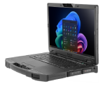
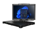
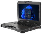
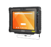
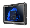
Tablets | Fully Rugged | 11.6-Inch | Windows
Getac F110
The F110 was named the Best Rugged Tablet in 2021 by ZDNet and in 2023 by TechRadar. It has a slim form factor and an 11.6-inch FHD screen.

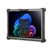
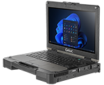
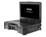
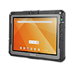
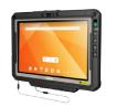
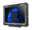
Tablets | Fully Rugged | 12.5-Inch | Windows
Getac K120
The K120 is a multi-functional tablet with 12.5-inch FHD screen. It is engineered to work through a variety of usage modes and accessories.

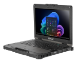
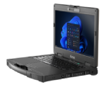
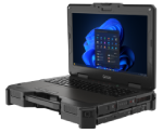
Laptops | Fully Rugged | 13.3-Inch | Windows
Getac B360
The B360 is PCMag Editor's Choice winner and Best Rugged Laptop awardee in 2023. It features a 13.3-inch FHD screen with 1,400 nits LumiBond display.
Android Configuration at Scale
GETAC deployXpress
A cloud-based deployment, configuration, and provisioning solution that brings scalability, precision, and over-the-air convenience to Getac Android ownership.
Reducing the Risk of Device Downtime
Getac Monitoring
Monitoring helps you know which devices are optimally working, and which are not, ensuring you have the technology you need when you need it.

One GPS, Multiple Applications.
Getac VGPS Utility
By replicating the physical GPS data to multiple virtual COM ports, VGPS helps ensure operational efficiency. One GPS, multiple applications.
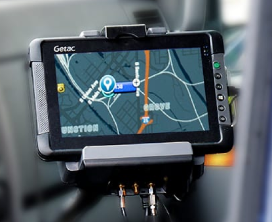
Getac Solutions on GPS Topographic Survey Equipment

Access to Mapping Data
With features like 4G LTE and IEEE 802.11ax Wi-Fi connectivity, Getac ensures professionals can access mapping databases and other vital topographic data in the field swiftly.

Sunlight-Readable Touchscreen
Thanks to Getac's LumiBond 2.0 technology, users can benefit from a sunlight-readable touchscreen display. Whether it's raining or shining, this feature enhances productivity in the field.

Devices with Digitizer Display Options
The digitizer pen from Getac offers a more accurate method for data entry, even allowing handwritten signatures. With its shortcut button, it replicates right mouse button functions, elevating the user experience.

Durable Hardware
Our devices are MIL-STD certified, which means they can withstand extreme temperatures, shocks, water, and drops.
They also have an Ingress Protection IP67 certification, which means they meet international standards for dust and water resistance. This means your devices will be protected from dust and moisture when you are working.
Future Trends and Advancements in
GPS Topographic Survey Equipment

Integration with Other Technologies
Artificial Intelligence (AI) and Machine Learning
These technologies can process and analyze vast amounts of data quickly, enhancing the functionality of GPS systems.
Internet of Things (IoT) and Smart Sensors
IoT can improve tracking and data collection in real-time, enhancing the overall capabilities of GPS equipment.
Augmented Reality (AR) and Virtual Reality (VR)
AR and VR can offer immersive visualization of topographic data, making interpretation easier and more intuitive.
New Positioning Techniques and Algorithms
The ongoing research promises more sophisticated algorithms and positioning techniques. These advancements will lead to even more accurate and faster results in topographic surveys.

Advances in GPS Technology and GNSS Systems
Emerging trends show a shift towards the combination and integration of multiple satellite systems, enhancing signal reception and accuracy.
CONCLUSION
Modern surveying leans heavily on GPS topographic survey equipment. The tools and techniques offered by this technology have revolutionized the land survey business, making it more efficient and precise.
As GPS technology evolves, the equipment becomes more sophisticated, guaranteeing that the future of topographic surveying is even brighter.
Getac Solutions continue to innovate, providing robust tools and efficient software compatibility that complement and enhance productivity when paired with other GPS topographic survey equipment.
ADDITIONAL RESOURCES

Factors Impacting the Utilities Sector Today and Tomorrow

How Rugged Mobile Devices Improve Customer Service in Utilities and Field Repair
